La Réunion Regional Council manages infrastructure development on the French overseas territory. Funding came from the regional council, the French state and the European Union.
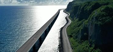
Réunion's Coastal Road: A real feat of engineering.
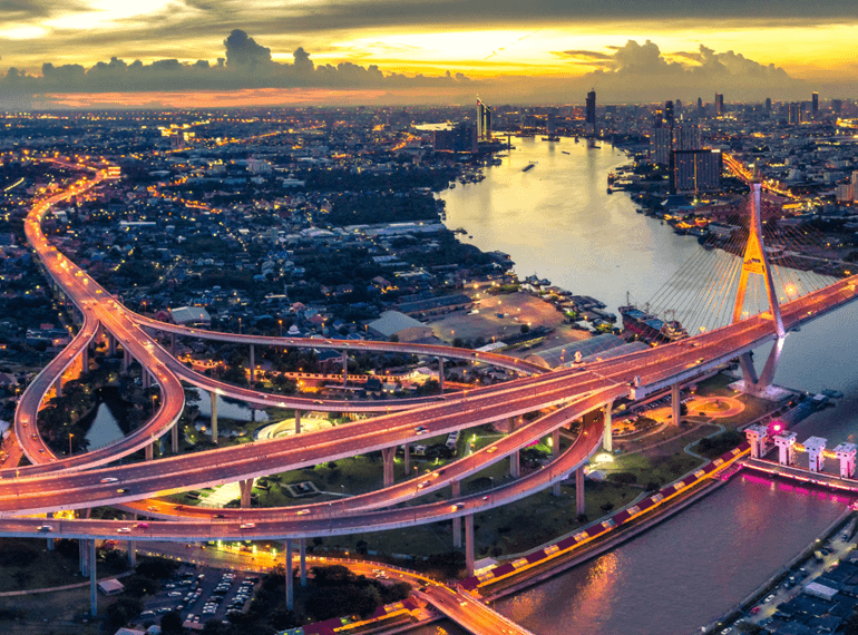
Réunion , France
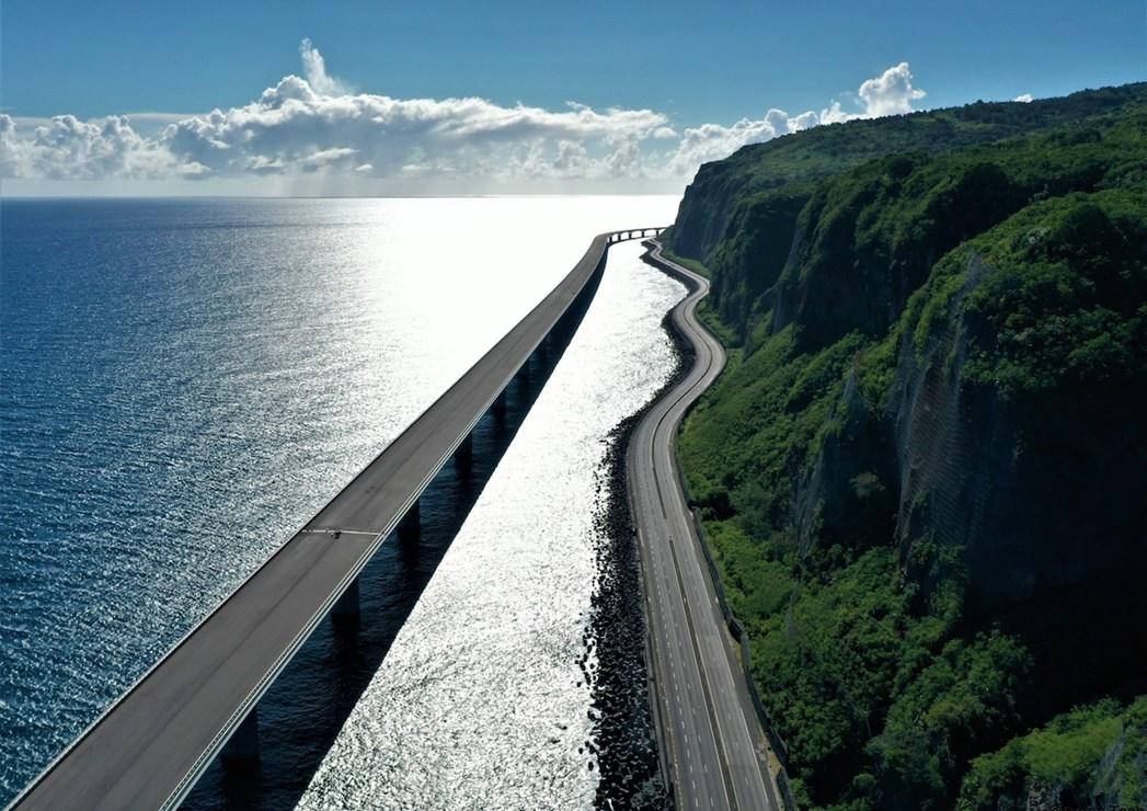
Réunion's new 12.4km-long coastal route is one of the world's largest, most complex road projects and a true feat of engineering.
Client
La Réunion Regional Council – Région Réunion
Timeline
2011-2022: Phase 1 – Saint Denis to La grande Chaloupe
2023-2030: Phase 2 – La Grande Chaloupe to La Possession
Benefit
- Faster, safer road travel
- Long-lasting infrastructure
- New eco-reefs
Outcomes
- 12.4km of new road
- 60,000 vehicles per day forecast
- Eco-friendly construction
About La Réunion Regional Council.
Safe, sustainable travel.
60,000 vehicles daily
Thousands will be able to travel more easily.
100 years minimum lifetime
The road infrastructure has been built to last
90km/h Average speed
A modern road allows faster, safer driving.
The challenge.
A coastal road threatened by landslides.
The existing coastal road between Saint-Denis (Réunion's capital) and La Possession, its main commercial port, was frequently struck by landslides along the island's cliffs. This made driving between the towns hazardous and frequently caused major traffic jams.
At the same time, physical limitations meant there was no additional space to widen the road and permit more traffic. This meant drivers had to travel at low speeds, which impeded the island's economic development. It also made the use of public transport between the two towns very difficult.
After reviewing all options, the local government selected a mixed solution with coastal viaducts and causeways as the most appropriate option.
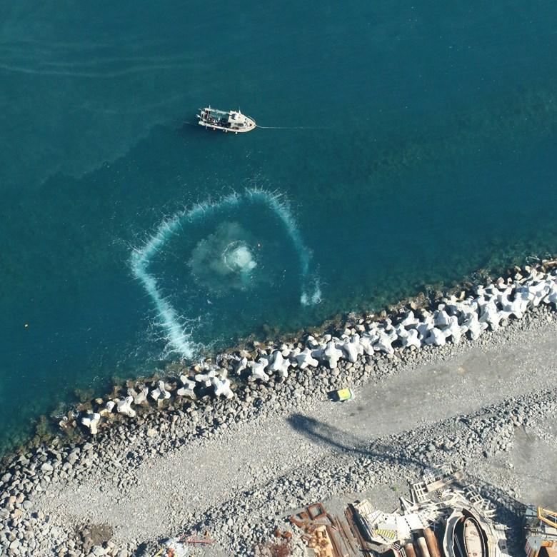
However, building a 12.4km road above the Indian Ocean was also a major technical feat. Pile foundations for the viaduct were built in waters that were up to 12 metres deep. The engineering team also had to factor in the viaduct’s exposure to extreme weather, cyclonic swells and abrasive saltwater. It also had to comply with the highest environmental standards and minimise disruption to underwater ecosystems.
Imagine.
Designing a safe, eco-friendly mega project.
We were tasked with designing a structure that would withstand extreme weather, have a minimal environmental impact and stand the test of time.
The project was of gigantic proportions and would require complex structures to be built at sea, far from the cliffs, at water depths between 5 and 12 metres.
The road is also situated in a hostile environment. It would be exposed to cyclonic swells, abrasive seawater and would need to avoid damaging areas of special ecological diversity. We also needed to account for the risk of seismic activity and the possibility of 300-ton ships striking the viaduct.
We brought together a highly technical, multidisciplinary team to design and implement the project from start to finish and overcome these challenges. Our teams were responsible for everything from the initial design of the viaduct infrastructure to managing traffic to complete project management and supervision of works.
Create.
Boosting driver safety, preserving marine life.
The New Coastal Road comprises more than 8,200m of viaduct and 4,200m of causeway, plus new road junctions. This highly complex project involved a wide range of technical disciplines, with much of the original design carried out with Building Information Modelling and a specialised hydraulic laboratory.
The causeway is one of the largest civil engineering structures ever designed in this field. It consists of a core of submerged rockfill material, a sunken abutment, a concrete block armour, a sea-proof retaining wall and rockfall protection.
Likewise, the viaduct required deep technical expertise. Immersed in up to 12 metres of water, the deck of the viaduct carries 2 x 3 lanes and can be adapted to include a tramway in future. The decks, 29 m wide, are of the prestressed caisson type, with variable or constant height depending on the case.
To erect the first viaduct, 5,400 m long and 20-30 m above sea level, we used a mega-barge and a 278m launching beam, weighing 2500 tons, to lay the 1176 segments of the deck.
Eco-friendly engineering
Our environmental engineers conducted a 12-month-long ecological study before construction began. To minimise disturbance, our teams used bubble curtains to control noise from the construction site. We also monitored water quality and installed coral-support mechanisms. We chose special lighting to avoid disturbing nesting birds and monitored marine life, including whales and turtles.
Achieve.
One of the world's largest road construction projects.
The first phase of the new 9.4 km coastal road from Saint-Denis to La Grande Chaloupe was completed and opened to the public in early 2023.
Phase 2 will see the opening of an additional 3 km section linking La Possession. Opening is currently scheduled for 2030. This new road means :
When operational, the wide, modern road will enable drivers of all vehicle types to comfortably reach speeds of 90 km/h, allowing them to travel between two major towns in record time. Landslides are a thing of the past, meaning there will be far fewer delays.
Sustainable infrastructure.
We designed the road to minimise and compensate for its environmental impact. We are continually monitoring suspended matter in seawater around the infrastructure to ensure it remains at safe levels.
It's also economically sustainable in that it's been designed to last at least 100 years. This means local people can be confident they can quickly and reliably travel between the two cities. It will also support development on the island and has been designed flexibly so it can support a tramway in future.